GPSを使ったアプリケーション, Products, Android Location
abstract#
information for one of my applicationtopics#
what#
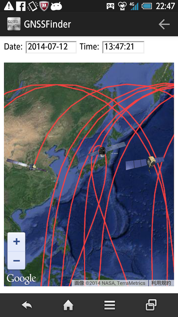
GNSS Finder can provide two kinds of view; Camera view and Map view. Camera view provides AR (Augmented Reality) view. so user can see which direction and elevation of GNSS satellites from user location by using users' camera in the android. Map view provides the ground track of GNSS with world Map.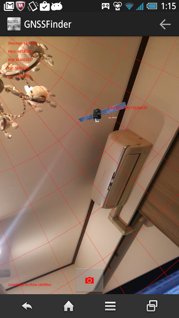 |
 |
how to start#
androidのアプリケーションをGoogle Playで利用可能にしています。GNSSFinder
program source#
ソースは、GitHub
Known Issues#
- Map cannot work
| I updated braincopy website from http to https. I need to update the reference information from GNSSFinder to braincopy map pages. I used Google Map, but, by using this opportunity, I like to change it to Open Street Map by using my knowledge related OSM Plugin. |